Senior Editor: Alan Agbele
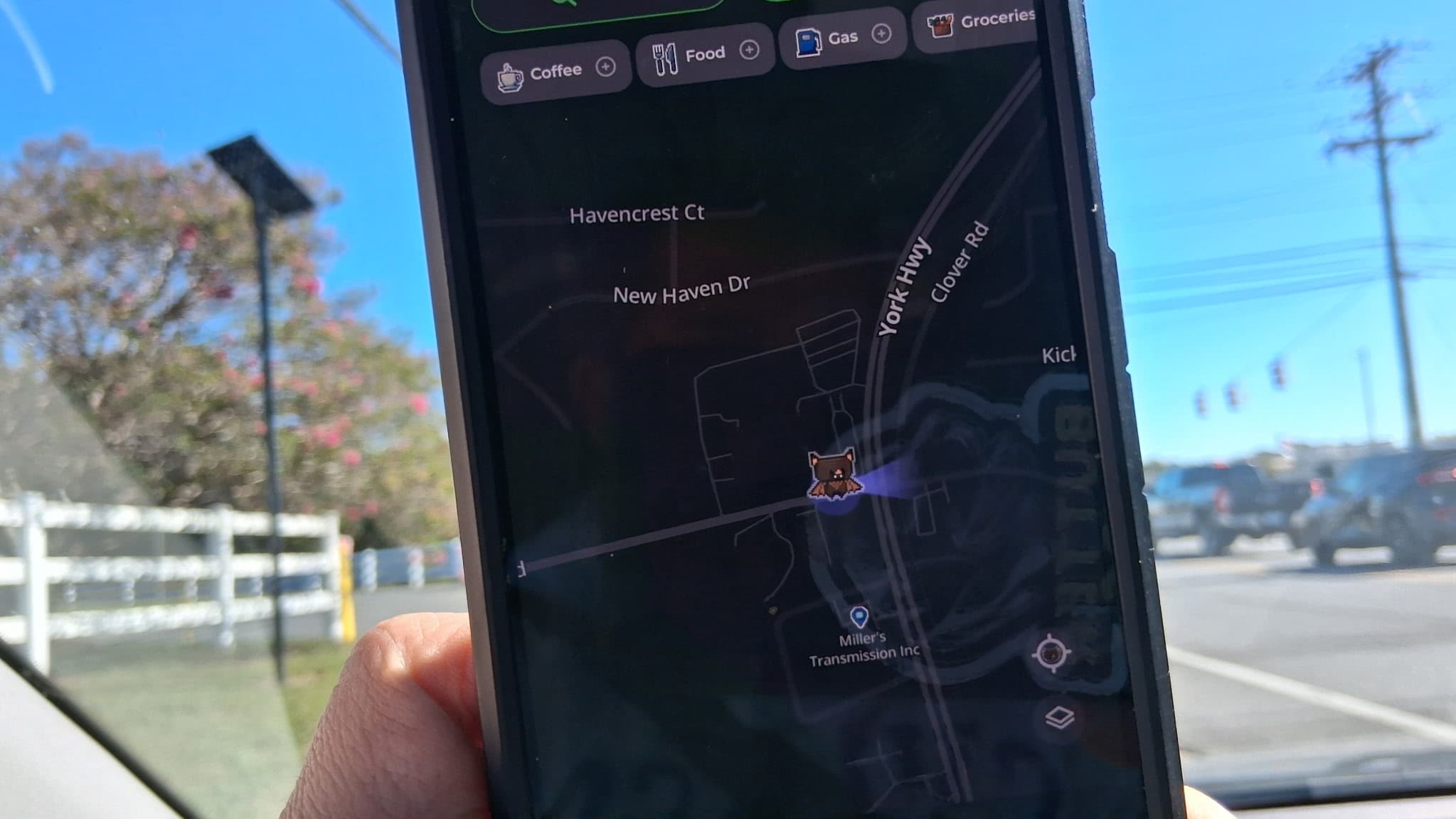
MapQuest has added a surveillance layer that plots Flock license plate reading cameras directly onto its maps, giving ordinary users a way to see how much automated tracking infrastructure sits in their own neighborhoods. The feature turns a legacy navigation brand into an unlikely transparency tool for a technology most people never see.
Why a Navigation App Became a Surveillance Map
MapQuest built its reputation on routing drivers from point A to point B. Layering surveillance infrastructure onto that same map changes what the product is for. The company is effectively treating camera locations as a geographic data category, alongside restaurants and gas stations.
That shift matters because it normalizes the idea that tracking hardware is part of the built environment. A driver checking a route now sees the same map that a privacy researcher would use to document camera density.
How the Flock Layer Works in Practice
The layer draws on publicly available information about where Flock cameras have been installed. Users can toggle it on and scan a neighborhood for nearby readers. The practical effect is a quick visual answer to a question that previously required public records requests or crowdsourced spreadsheets.
Coverage, however, depends on disclosure. Departments that do not publish camera locations may leave gaps on the map. The tool is therefore a starting point for scrutiny, not a complete inventory.
The Transparency Gap Behind Camera Networks
Automated license plate readers have spread quietly across U.S. roads over the past decade. Police departments value them for recovering stolen vehicles and building investigative leads. The same systems, however, create detailed movement records for people who are never suspected of anything.
That tension has fueled a steady push for public camera registries. MapQuest's layer does not resolve the policy debate. It does, however, lower the effort required for ordinary people to participate in it.
Why This Matters
The direct consequence is a shift in leverage. Residents who once had no easy way to know whether a camera watched their street can now look it up in seconds. That visibility makes it harder for agencies to expand camera networks without public discussion.
Camera vendors also face a new dynamic. When deployment maps are one click away, contracts that once passed quietly may attract organized opposition. Cities weighing renewals should expect residents to arrive at council meetings with screenshots.
For MapQuest, the feature is a bet that location data can be civic infrastructure, not just a routing utility. Whether rivals follow will reveal how much demand exists for surveillance transparency as a mainstream map feature.