Editor: Porcia Akua Holmes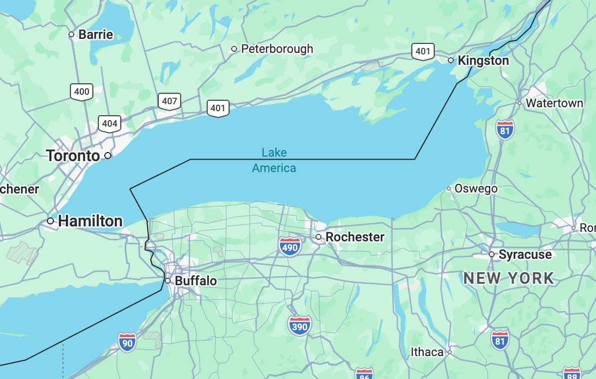
Google Maps has begun displaying Lake Ontario as “Lake America” for some users, making it the first major online mapping service to comply with an executive order from Donald Trump that directed the name change. The alteration affects one of the five Great Lakes and signals a new intersection between political authority and digital cartography.
How the Rename Reached Google Maps
Donald Trump signed an executive order requiring the federal government to officially adopt “Lake America” for the body of water historically known as Lake Ontario. Google, which maintains its own mapping database, updated its platform to reflect the new name in certain regions. The company did not announce the change publicly, but users reported the update on social media.
Google’s decision to comply places it ahead of other mapping services such as Apple Maps and OpenStreetMap, which have not yet made similar adjustments. The move underscores the influence of executive orders on digital infrastructure that millions of people rely on daily.
Why This Matters
The Lake Ontario rename represents a direct challenge to the consistency of digital maps. When a single platform alters a centuries-old name based on an executive order, it creates confusion for navigation, education and cross-border communication. The decision also sets a precedent: other tech companies may face pressure to follow Google’s lead, potentially fragmenting geographic data along political lines. For users, the change erodes trust in maps as objective tools. For regulators, it raises the question of whether private platforms should act as arbiters of political naming disputes.
Broader Implications for Digital Mapping
This incident is not isolated. Donald Trump previously directed the renaming of the Gulf of Mexico to “Gulf of America,” though that change has not been widely adopted by mapping services. The Lake America case, however, shows that executive orders can quickly reshape digital geography when a dominant platform like Google complies.
The episode also highlights the lack of an international standard for map names on private platforms. Unlike official government charts, which follow strict naming protocols, consumer mapping apps can be updated without public debate. This flexibility can become a liability when names are politicized. Historians and cartographers have criticized the move, arguing that renaming a geographic feature without broad consensus erases cultural and historical context.
What You Need to Know
Users in the United States may already see “Lake America” on Google Maps. The change does not affect other mapping services or official government nautical charts unless those bodies also adopt the executive order. Anyone relying on Google Maps for navigation or geographic reference should be aware that the name could shift back if a future administration reverses the policy. The situation serves as a reminder that digital maps are not static; they reflect the political and corporate decisions behind the screen.