Editor: Porcia Akua Holmes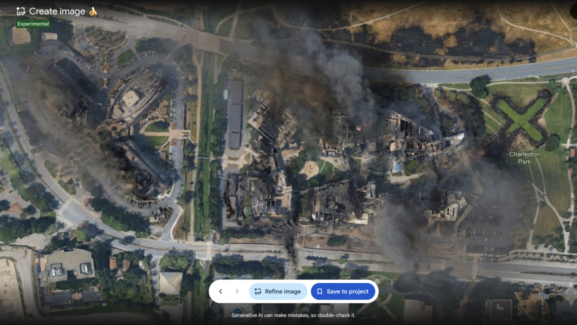
Google Earth launched and abruptly withdrew a feature that allowed users to generate AI-modified versions of real satellite imagery, testing the boundaries of synthetic media in mapping tools. The company promoted the integration of its Nano Banana 2 image generator as a way to create custom images grounded in authentic geospatial data, but critics immediately flagged the potential for misinformation.
How the Feature Worked
On July 30, Bryan Horowitz, product manager for Google Earth, announced in a company blog post that users could generate custom images using Google Earth's satellite, aerial and 3D imagery alongside Nano Banana. “For the first time, you can generate custom images using Google Earth’s satellite, aerial, and 3D imagery alongside Nano Banana, which creates concepts grounded in the real world,” Horowitz wrote. The tool allowed anyone to produce AI-modified versions of authentic imagery depicting real locations, something that Google had previously avoided offering.
The Rapid Reversal
Within days of the launch, examples of altered satellite pictures circulated online, showing how easily the feature could be used to create misleading depictions. Google quickly retracted the tool, reversing its earlier decision. The company did not immediately explain the reasoning, but the move came amid widespread discussion about the risks of synthetic geospatial content. Google, however, had touted the feature as a breakthrough for creative expression.
Why This Matters
This incident signals a turning point for how tech giants integrate generative AI into products that rely on factual representations of the physical world. Google Earth has long been a trusted resource for researchers, journalists and the public. The rapid adoption and reversal of the Nano Banana tool shows that even large companies can misjudge the consequences of blending AI with real-world data without robust safeguards. Moving forward, mapping platforms will face pressure to implement stronger content authentication and transparency measures. The episode also reinforces the need for industry standards around synthetic geospatial media before such tools become widespread.
What the Episode Means for Tech Policy
The brief availability of the feature raises questions about Google's internal review processes. The company initially saw the tool as a creative addition, but the public reaction forced a quick retreat. Regulators and advocacy groups may now call for clearer rules on how AI-generated images can be labeled and distributed, especially when they simulate official mapping data. Google, for its part, will likely tighten its approval pipeline for future AI features that touch on geographic authenticity.